Alamosa County
Alamosa County is centered in the middle of the San Luis Valley, and offers unique outdoor recreation, majestic views, trail systems, steam engine train rides and quiet dark night skies in a quaint railroad and agricultural town. Walk along the trail systems of the Alamosa Ranch or paddleboard along the Rio Grande River. Explore one of three local breweries or ride on the Denver and Rio Grande Railroad. Hike up and sand board down the nation’s highest dunes at Great Sand Dunes National Park and preserve or quietly view a variety of birds and wildlife at the Alamosa Wildlife Refuge or Blanca Wetlands. View Colorado Alligators or take a dip in a hot springs swimming pool. Dine at local family own businesses or take lunch on the road and play a round of Golf at Cattails Golf Course. Stroll around Alamosa’s downtown to experience its history and small-town charm. From red brick to pressed metal ornamentation, Alamosa is a study in the architectural trends that have passed through the nation since the 19th century. There are also 16 locations on the National and State Register of Historic Places. Fine tune your historical knowledge by visiting the San Luis Valley Museum and the Luther Bean Museum.
From July to October stop by the Valley Farmer’s Market in Alamosa. This weekly market features local produce from farmers and unbelievable baked goods from local Amish and Mennonite families. In the fall, follow your nose to witness the roasting of New Mexico and Colorado chilies.
Here on a summer Sunday evening? Join the locals for the Alamosa Live Music Association Sundays @ Six free concert series every Sunday, starting at 6pm in Cole Park from June through August.
During the winter months, be sure to catch the Rio Frio Ice Festival, which includes a 5K on the frozen Rio Grande, Ice Carving, Ice block bonfire, sub-zero plunge and great local eats and drinks. Experience climbers can ascend the frozen face of Zapata Falls. Cross country ski under the Colorado blue sky with uninterrupted views in every direction. Ice Skate and play indoor sports and the Alamosa Recreation Center and catch live music and activities at local restaurants, bars and breweries, and at Adams State University campus.
Alamosa offers a variety of places to stay during your visit. You can camp at the dunes or local RV site, stay in a comfortable hotel or get an authentic cowboy experience at the Zapata Ranch. Learn more about amenities in Alamosa by visiting https://www.alamosa.org/
Cities in Alamosa County
Alamosa
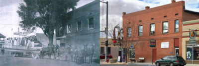
1878 – Alamosa, at first called “Rio Bravo” because the town was located on the bank of the “raging” river. The “Alamosa” Town Company was platted by A.C. Hunt as the new railroad hub. The first building was brought by railroad flatbed from Garland City. The hotel was set on the corner of 6th and Hunt. Locals joked that they had breakfast at Garland City and supper in Alamosa, all at the same hotel restaurant. The town was named “La Villa Alamosa” or “Alamosa” in reference to the abundance of Cottonwood trees along the river.
In the summer of 1887 Alexander Cameron Hunt selected the location that would become Alamosa.
He wrote, “…beyond La Veta Pass lands us in the very center of the most arable land to be found in Colorado or the whole Rocky Mountains, and when the facilities for irrigation are considered in all their bearings, I believe I can say with safety that no other locality with equal advantages can be found between the Gulf of Mexico and the British possessions. The spot where I have stopped the rails, as shown on the map of the country (enclosed) which is christened Rio Bravo is upon the southwest bank of the Rio Grande equidistant from the two ranges of mountains.”
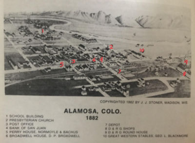
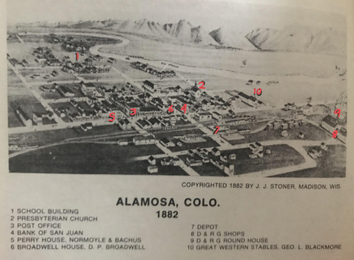
Joe Perry, owner of the Perry House (Number 5 on the map from 1882) boasted that he pulled off the best inn-keeping feat: serving breakfast to his patrons in Garland City in the morning and serving them dinner in the same building in Alamosa that evening. You can see how the town grew quickly by 1882 and even more so by the 1940s.

Alamosa
Hooper
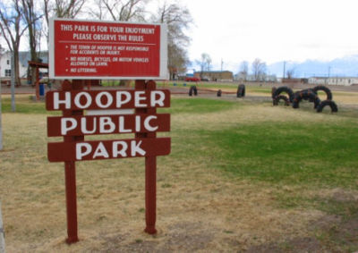
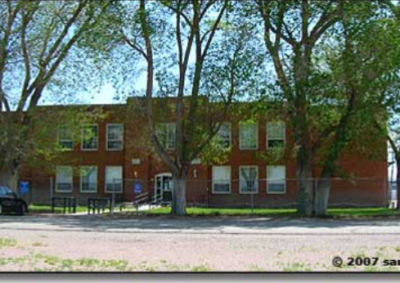
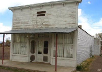
1890 – Hooper, originally called “Garrison” in honor of a local merchant. The name was changed to “Hooper” in honor of Major Shadrock Hooper. Info by Dennis Lopez

Hooper
Mosca
1890 – Mosca was a stage coach stop between Pueblo and Alamosa, coming over Mosca pass. The town was originally called “Streator” the town in Illinois from which many of the settlers came. The residents moved the whole town so it would be in line with the railroad, which they anticipated would come into the valley over Mosca Pass. In this expectation, the town built the largest flour mill in the valley with two elevators, two lumber yards, two hotels, two blacksmiths, two barbers, two druggists, two churches and one saloon. The name was changed when a Post Office was established and named “Mosca” due to the pass. When the Denver and Rio Grande Railroad came over La Veta pass instead, Mosca lost its future as a boom town.


Mosca
Waverly
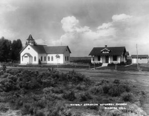
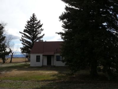
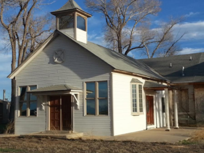
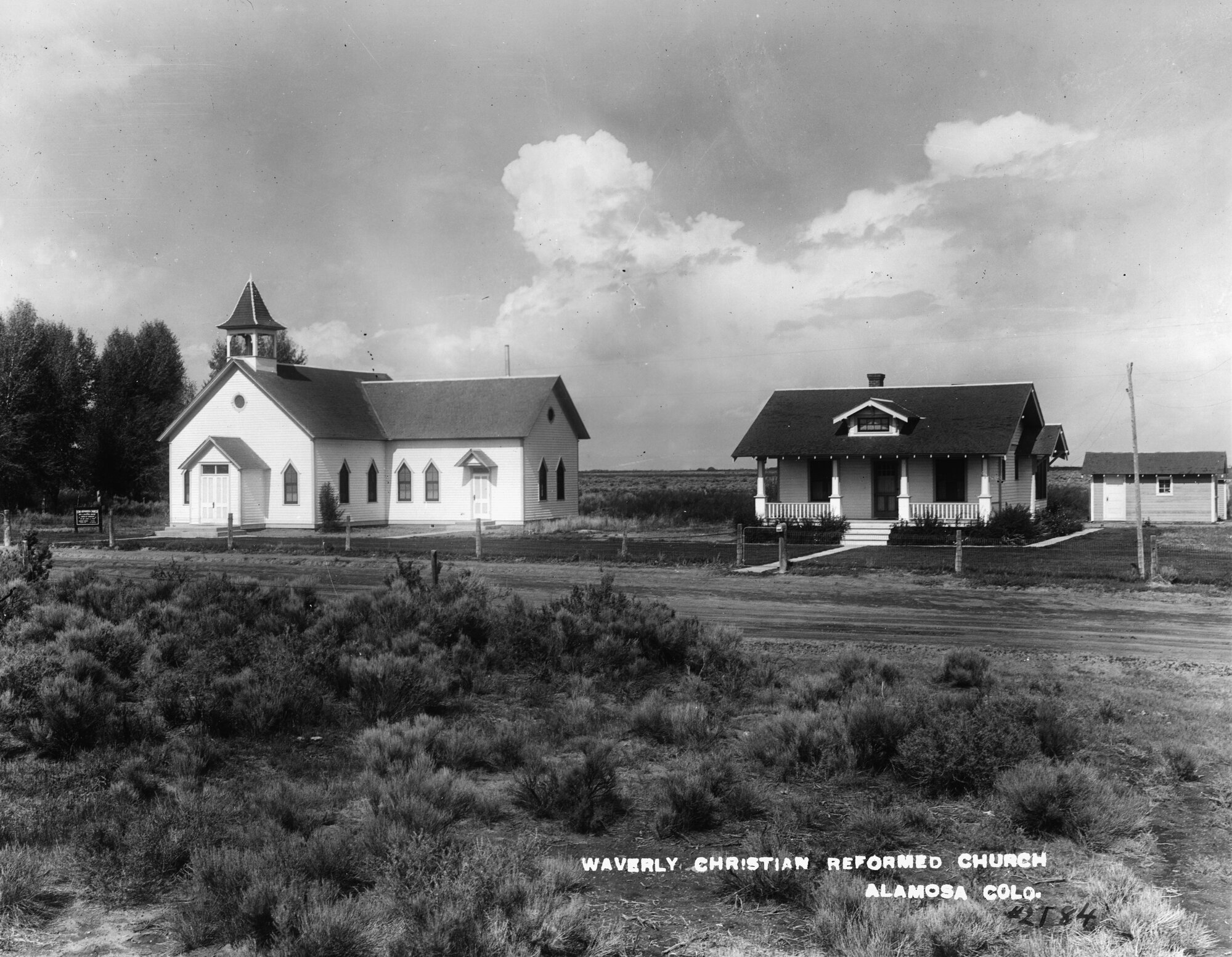
1937-38 –Located in Alamosa County, this rural area was settled by families who immigrated from the Netherlands and farmers to were relocated during the 1930s Dust Bowl. An appealing brochure from a private contractor lured families from the Netherlands promising great farming land and nice climate. Arriving at the Alamosa railyard in 1892, the travelers who sold all their possessions for a new promising life were disappointed. They traveled far to find that the area looked nothing like Holland, and frigid temperatures. The new settlers were promised homes and land, only to find that they had been swindled. Multiple families and those who survived the journey were housed in a few structures in Alamosa until they were able to move into an empty schoolhouse to begin construction on their homes during the warmer months in the now Waverly area. The construction of the Dutch Reformed Church, now known as Christian Reformed Church, began in 1908. School was held in this church until a two-room school was built in 1912. Well known descendants of the new settlers include VanGieson, VanIwaarden, Wiescamp, Hof and numerous others. Waverly attracted pioneer farmers who emigrated from across the county after conditions from
the 1930s Dust Bowl and the Great Depression forced them to leave their homesteads for a brighter future. The New Deal’s Federal Government’s Resettlement Administration created a program offering farmers of the Dust Bowl they would be able to get a second chance on land where farms could be established. Each farm would consist of 90 acres, a small story and a-half home. Many newcomers stayed in Waverly and others found work elsewhere. Soon after, also in 1930, Japanese Americans settled near Waverly. Their agricultural talents included potatoes, lettuce and garden peas, and introduced cabbage, cauliflower, spinach and carrots.
Waverly
Conejos County
Nature and wildlife lovers, sports enthusiasts, and history and culture seekers will be in heaven as they explore the backcountry of Conejos County. A generous 66 percent of the land is public land, overseen by the National Forest Service, Bureau of Land Management (BLM) and State of Colorado, providing endless locations for outdoor recreation and large game hunting. Camping sites and lodges offer outdoor adventurers an authentic rural frontier to explore under sun filled days and dark night skies. Fish pristine, gold medal waters of the Conejos River, and if you don’t want to go it alone, there are many guides and outfitters in the area. Fish species include, Trout, Northern Pike, Walleye, and Salmon. The San Juan Wilderness Area and eight State Wildlife Areas offer miles of hiking for all ability levels, ATV and primitive four-wheel drive trails, and cross-country skiing or snowmobiling is an option for the winter months. Visit the Colorado State Wildlife site for details on trails.
Volcanic activity deposited gold, silver, and turquoise in Conejos County in the areas of Platoro and the King Turquoise Mine. In the summer months you won’t want to miss events like La Jara Glory Days, Manassa Pioneer Days and Antonito’s Labor Day festival.
Conejos County is home to the Cumbres and Toltec Scenic Railroad, America’s longest and highest narrow gauge steam railroad, the oldest Hispano civil rights union, the S.P.M.D.T.U. , and Mission churches dot the landscape, with the largest and oldest being Our Lady of Guadalupe. Several museums can be found throughout the small towns, which depict early frontier life of southern Colorado. There are state and national historic sites throughout the county like Pike’s Stockade and Lobato’s Bridge, which is just a stone’s throw away from where Don Diego de Vargas first crossed the Rio Grande.
Towns in Conejos County
Antonito
The railroad located the train station one mile south of Conejos. One rail line went west to Chama and the second line went south to Española and was called the “Chile Line”. When a petition for a post office was made, the name of San Antonio was taken, so “Antonito” or “Little Anthony”, became the official name. It was in honor of the nearby mountain, named San Antonio by explorer, Governor Diego de Vargas.
“The Antonito location was an important one for the railway company because it was the junction where two lines would separate, one continuing south to Espanola and Santa Fe, and the other turning west to Durango and Silverton. After Antonito attained this distinction it grew larger than Conejos but for a number of years the people of Antonito had to go to Conejos to fulfill their religious duties. This situation was changed by the building of St. Augustine’s Church in Antonito.” Monsignor Patrick C. Stautor, 100 Years in Colorado’s Oldest Parish (Denver: St. Cajetan’s Press, 1958)
The Benedictine Sisters from Motherhouse in Atchison, Kansas came to Antonito in the autumn of 1934 to conduct the public school of the district. There were eight sisters the first year with Sister Cyrilla, O.S.B. as the principal. The student body at the time was around 200.
“Let it be said for future records that when these teachers began to instruct the institution, the public school district was bankrupt and even the physical facilities of the educational plants had fallen into quite a state of disrepair, so that among other things windows were without panes of glass. It was at this point that Rev. John Ordinas, C.R. offered to the school board his services in securing the Benedictine Sisters from Atchison to take over the school. According to Frank McCuniff, long time secretary of the school board, ‘The benedictine Sisters took over when no one else wanted the burden. The year before the coming of the sisters, school had been conducted only for three months. No one wanted to teach in the school because the teachers had to accept county anticipation warrants instead of cash. These warrants were being honored by merchants at discounts running as high as forty percent. The first year no salary at all was given to the sisters. The second year they were given $75 a month per teacher. Under the Benedictine Sisters, the Antonito schools have produced a number of outstanding students who have distinguished themselves in civic and cultural activities and the number of college degrees from the ranks of the Antonito graduates runs higher in proportion than in other localities of the Valley where people of Spanish-speaking backgrounds predominate.” Monsignor Patrick C. Stautor, 100 Years in Colorado’s Oldest Parish (Denver: St. Cajetan’s Press, 1958)
“In Antonito, John Sargent started the Sargent Mercantile Company on the west side of the main road at the south end of town in 1920. At Sargent’s death in 1934, Buddy Middlemist’s mother and his father, Pete Sr. moved from the Denver area to Antonito to manage Sargent’s 20,000 head of sheep.They were also involved in Sargent’s Mercantile along with Buddy’s grandmother and two of his uncles. Sargent Mercantile was an important part of the San Luis Valley community with hundreds of families putting their supplies on account. Many of the area’s residents were involved in the sheep business and when it was time to send their sheep to market, they sold them to the mercantile. The amount owed on account was deducted from the amount paid back to the customer for their sheep. Sheep were then sent to a Denver market where Buddy’s paternal grandfather had business interests. Sargent Mercantile burned in 1952 but Buddy’s grandmother salvaged records of the accounts that were stored in a safe. For a time, they set up shop in the pool hall to collect monies owed but Pete Middlemist Sr. eventually bought the town’s flour mill and reopened the store in that building on the north side of town. Most of the accounts were recovered and Pete Middlemist Sr. continued as the store’s sole owner until 1973 when it closed permanently.” 2020 Archaeological Investigations in the Rio Grande Natural Area and Punche Valley, Conejos County, Colorado, edited by Christopher M. Johnston, pp. 21-74. Research Contribution 113. Archaeological Investigations in the San Luis Valley 5. Paleocultural Research Group, Broomfield, Colorado.
Fred Warshauer and the Warshauer Mansion- Large sheep and cattle ranches also began to spring up around Antonito, with wool becoming one of the community’s major exports. River Street was the home to many of these wealthy ranchers, with Victorian homes lining much of the street, including the Warshauer Mansion, home to wealthy sheep herder Fred Warshauer. The Warshauer Mansion would have been better suited to Denver’s Capitol Hill or Colorado Springs’ posh Broadmoor district than Antonito’s River Street. But, Fred Warshauer made his fortune in Antonito and that was where he chose to build his dream home. “The first Warshauer home was destroyed by fire in 1911. The next year, the mansion was built on the same site, The architect and builder both came from Denver. The magnificent house sat in the middle of a square block bordered by an elegant iron fence and lilac hedge. A real showplace in an area of adobes, the house had lovely hand painted murals and richly carved woodwork. The furnishings came from the finest stores in Denver and the east. It was the scene of lavish parties catered by Denver firms.
Washauer was a German immigrant who arrived in the San Luis Valley in the 1880s, settling in Conejos. For a few years, he worked for a merchant there while learning to speak both English and Spanish. In 1889, he organized his own real estate and loan office in Conejos. Then, in 1902, he moved to Antonito and expanded his business to include the buying and selling of wool. He also became involved in the raising of sheep and made one of the county’s great fortunes. “Warshauer did not live to enjoy his mansion for very long. Suffering financial reversals, he took his own life in 1913.” Leland Feitz, Conejos County, A Quick History: Colorado’s Land of Many Contrasts (Colorado Springs: Little London Press, 1995).
Perlite Mines- A perlite mine was also established just south of Antonito in No Agua, New Mexico. A mill established a mile south of town was erected to process railroad car loads of perlite. At its height in the 1980s, the perlite industry employed 125 workers.
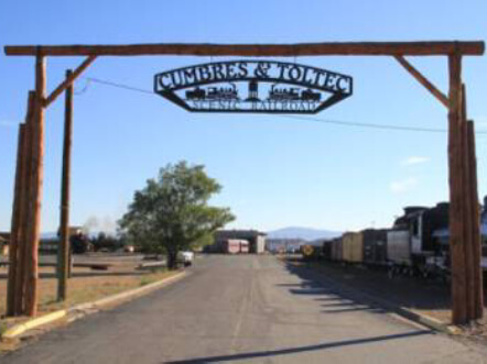
Cumbres and Toltec Scenic Railroad- While the Chili Line ceased operations in 1941, the San Juan Extension continued use until 1968 when the D&RG contemplated abandoning the route. In 1970, the states of Colorado and New Mexico joined together to save part of the San Juan Extension that ran from Antonito to Chama, New Mexico. This portion of the railroad would be renamed the Cumbres and Toltec Scenic Railroad, where today it is used to show tourists what an authentic journey along the railroad would have looked like during its heyday.
Governor Ralph Carr- “Before moving to Denver and into a career in politics, Ralph L. Carr practiced law in Antonito. He also served as the county attorney for Conejos County. Ralph spoke fluent Spanish and had a bond with the Hispanic Community of the San Luis Valley. Ralph helped the community with their legal problems. He was also familiar with the small Japanese community town of La Jara. In these communities, Ralph saw what it meant to be an American, since most American families had origins outside of the United States. It was in these communities that Ralph realized the Japanese American people weren’t secretly against the United States, and that the country was indeed a culturally diverse nation. He served Colorado as its governor from 1939 until 1943. “One of the state’s most popular governors, the Japanese population was especially devoted to him. Carr was the nation’s only governor, and one of a few in all of government, who stood by the native-born Japanese during World War II when many of them were badly treated and even relocated into concentration-like camps. “A life size bust of Governor Carr with these words, stands in Sakura Square in downtown Denver with a plaque that reads: ‘In the hysteria of World War II, when others in authority forgot the noble principles that make the United States unique, Colorado’s governor Ralph L. Carr had the wisdom and courage to speak out on behalf of the persecuted Japanese American minority. “They are loyal Americans,” he said, “sharing only race with the enemy.” He welcomed them to Colorado to take part in the state’s war effort and such were the times that this forthright act may have doomed his political career. Seeking refuge from the west coast’s hostility, made new homes, and remained to contribute to Colorado’s civic, cultural, and economic life. Those who benefited from Governor Carr’s humanity have built this monument in grateful memory of this unflinching Americanism, as a lasting reminder that the precious democratic ideals he espoused must forever be defended against prejudice and neglect.’
Fred “Lightning Heart” Haberlein-Frederick Fitzjarrald “Lightning Heart” Haberlein, was born December 7, 1944. He grew up at the Conejos Ranch on the Conejos River in southern Colorado. Fred graduated from Antonito High School, attended Colorado State University with a degree in sculpture and anthropology and attended graduate school at Arizona State University, where he studied printmaking. During and after graduate school, Haberlein lived in Oracle, Arizona., working alongside other artists at Rancho Linda Vista. In 1984, Fred returned to Conejos Ranch and began painting murals in Colorado, the first of which was a Virgin Mary for his high school classmate Johnny Johnson, who was nearly killed in the Vietnam War.Haberlein went on to complete 80 murals in the San Luis Valley before moving to Glenwood Springs with his wife, Teresa Platt, in 1988. He continued mural work, completing 140 pieces of public art including pictures on the main streets of Glenwood Springs, Carbondale, Leadville, Gunnison, Salida, Alamosa, La Jara, Romeo and Antonito. For 18 years, Haberlein taught Drawing on the Right Side of the Brain at Colorado Mountain College. He sadly succumbed to esophageal cancer in 2018.
La Sociedad Proteccion Mutua de Trabajadores Unidos- Members of the Hispano population of the San Luis Valley, a population that had resided in the area since the middle of the nineteenth century, organized to form La Sociedad Protección Mutua de Trabajadores Unidos (“S.P.M.D.T.U.”) (The Society for the Mutual Protection of United Workers). The very first meeting of the S.P.M.D.T.U. was on November 26, 1900, and was attended by residents of the town of Antonito, Colorado. The meeting was held at the home of the principal founder of La Sociedad, Celedonio Mondragon.
Celedonio Mondragon was born in Cenicero, a small hamlet east of Antonito, and had moved to Santa Fe, New Mexico to work as a platero (jewelry maker). While in New Mexico, Mondragon was a part of other mutual aid organizations and groups that had sprung up, including La Orden de Caballeros de Proteccion Mutua por la Ley y Orden (Order of Knights for Mutual Protection in Law and Order). After moving back to Conejos County, Colorado, Mondragon organized members of Antonito and the surrounding small communities and used the constitution of La Orden de Caballeros de Proteccion Mutua por la Ley y Orden, as well as the rules of the Order of Saint Francis of Assisi to form the ideological principles of the S.P.M.D.T.U.
The first concilio (council), the Concilio Superior, was founded in Antonito, and in 1925 the fraternal lodge on Main Street was built. From here, the board of directors began to organize local concilios, not only throughout Conejos County, but throughout the southwest, encompassing the entire states of Colorado and New Mexico, and even expanding into portions of Utah. Rivera, Jose A. La Sociedad: Guardians of Hispanic Culture Along the Rio Grande. Albuquerque, New Mexico: University of New Mexico Press, 2010. Saenz, Charles Nicholas. “Colorado’s Hispanic Frontier: Spanish Exploration and the Early Settlement of the Conejos and Sangre de Cristo Land Grants.” Essay. In The Geology, Ecology, and Human History of the San Luis Valley, 354. Louisville, Colorado: University Press of Colorado, 2020.


Antonito
Romeo
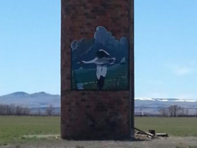
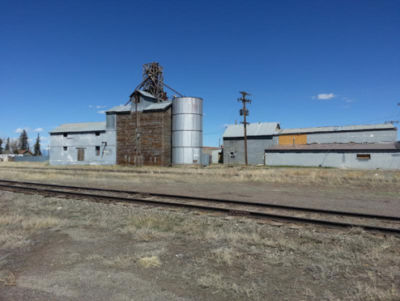
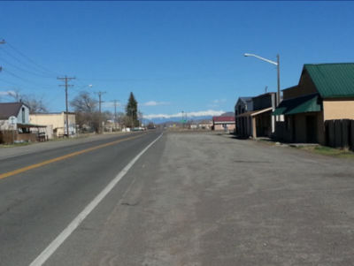
1874 – First established as “Sunflower” by Mormon settlers. A gentleman by the name of Romero petitioned for a Post Office for the community and the name “Romero” was already in use in Colorado. To get around the problem, Mr. Romero removed the second R from his name, thus the Post Office and eventually the community were named Romeo.
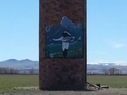
Romeo
Platoro
1880 – Gold was discovered at the Mammoth Mine. As the miners dug deeper into the mountain, a rich vein of silver was also discovered. The mining town was given the name for silver and gold, or “Plata” for silver and “Oro” for gold, thus the combined name of “Platoro”.
A post office was established in 1888.


Platoro
Sanford
In November of 1880, Silas Sanford Smith arrived in the San Luis Valley to take up permanent residence. Silas was a cousin of Joseph Smith, prophet and founder of the Mormon Church, and played a vital role within the Mormon community. In 1885, President of the Mormon Church John Taylor visited the area which eventually became Sanford, and remarked that the area would be suitable for settlement due to it being on higher land and accessibility to irrigation from the Conejos river. The town was initially to be called “Alma,” but it was soon discovered that there was already a town in Colorado with that name. Officials and residences decided to call the new settlement “Sanford” to honor Silas Sanford Smith. In 1886, the town of Sanford experienced an influx of new residents, and soon a log house was erected which served as a meeting house and a schoolhouse. It is estimated that in 1888, Sanford had over 140 families and a population of 654. According to records, the entire town of Sanford was composed entirely of settlers from Utah. (Information and photos taken from: History Colorado, Denver Public Library, Brigham University, and Colorado Magazine.)
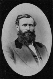
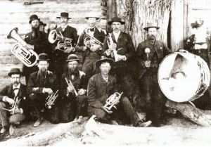
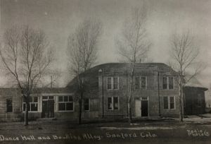

Sanford
Manassa
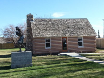
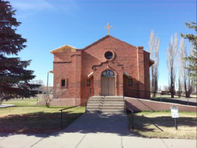
1879 – Named by Lawrence C. Peterson, a Mormon from New Mexico in honor of the biblical Joseph’s son. Settlers included Milton Evans, Samuel Sellers, William Jones, Thomas Chandler, Hugh Sellers, and their families. They came in October, 1878 and were caught by a severe winter storm. They survived the winter because they were taken in and given shelter and sustenance by the local Hispano settlers.


Manassa
San Antonio
1867 – Civil War Veteran, José María Casías homesteaded the settlement to raise sheep. Casías named the settlement San Antonio because it lays near the foot of “El Cerro de San Antonio”
San Antonio Mountain is a mountain located entirely within the State of New Mexico. The mountain was at one time volcanic, like many of the other hills and mountains around the southern part of the San Luis Valley. There is a volcanic rock mine on the southern end of the mountain in New Mexico that the New Mexico Department of Transportation uses for highways during the winter months.
Another school that had been settled on the east side of the river eventually became a Catholic church, dedicated in 1954, dedicated to the community as a mission church of Our Lady of Guadalupe Parish.
Originally settled on the east side of the San Antonio River, the community spread to the west side of the river as well where a school was built.


San Antonio
La Jara
1870 – Establish on the banks of La Jara creek by the same settlers from Capulín. Other settlers from El Rito, N.M. also joined the new community. The town was named for the “jaras” red willows that grew along the creek’s banks. When the railroad extended south from Alamosa, the town moved to the railroad stop at the water tank location. The name moved with the town.


La Jara
Ortiz
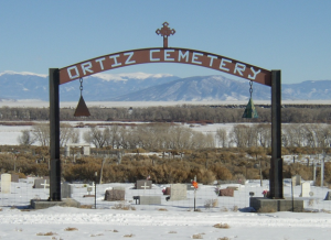
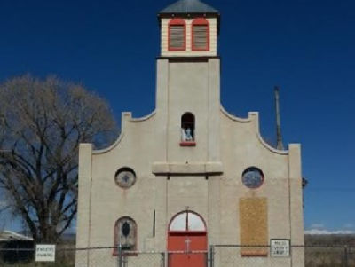
1870 – Ortiz, also known as “Los Pinos” the pines, was established by Nestor Ortiz who was a sheep rancher with a large flock. Nestor also opened a store in the community. A post office was opened in 1885 and given the name of Ortiz. Ortiz is six miles SE of Antonito and named after Nestor Ortiz who owned a store there. It was homesteaded in the early 1870s by Jose Maria Casias, but attempts to settle the area may have been made since the early 1840s.
The community at one time boasted over 500 residents, with stores, bars, and even a red light district being established in the community. A church was built in 1895, and in 1938 a new chapel was built just south of the old one. The community was renamed Ortiz due to the prominence that Nestor Ortiz had achieved. The name of the community was made official when a post office opened in 1895 inside Nestor Ortiz’s store.
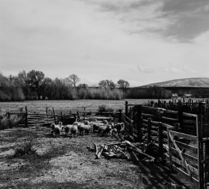
With the coming of the Denver and Rio Grande Railroad, the wool produced in Ortiz was shipped from Antonito, and sometimes Osier, to mills across the east coast. Oritz also gained importance due to the highway that ran through town being the road connecting Tierra Amarilla, New Mexico with Conejos, both communities being the county seats of Conejos County, Colorado, and Rio Arriba County, New Mexico.
While the community was renamed Ortiz, many residents continued to call the community “Los Pinos,” which continues to this day with some older residents continuing to call the community by the name it originally had. Ortiz is unique as the Colorado-New Mexico border runs right next to the community, and so while some community members call Ortiz home, their residences are actually located in New Mexico.
“Early Settlements of Southern Conejos County,” The San Luis Valley Historian XXIX, no. 4 (1997).
Leland Feitz, Conejos County, A Quick History: Colorado’s Land of Many Contrasts (Colorado Springs: Little London Press, 1995).

Ortiz
Los Sauces
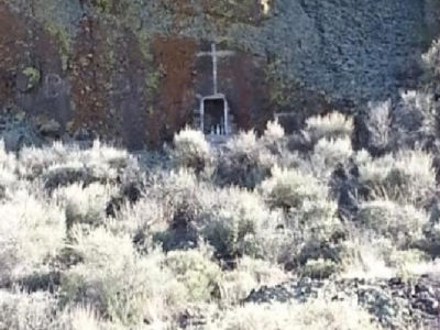
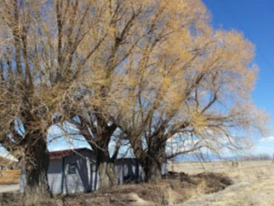
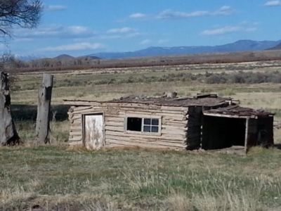
1863-64 – Los Sauces, the “willow trees” was founded by Antonio Márquez, José Rodríguez, and Fernando Borrego and their families. The town was named for the abundance of willow trees in the area.
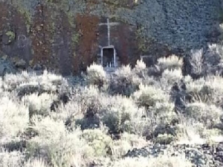
Los Sauces
Capulín
1858 – Capulín was settled by residents from the Conejos and El Rito, N.M. areas. Capulín was founded near a grove of choke cherry trees and given name of this tree “capulín”. Founding fathers were: Hipólito Romero, Juan and Fermín Gómez, Tomás Sánchez, Victor Gonzales, and Bernardino Valdez. The town was built of jacales and burned down. The town was moved west about a mile and a half in 1867 to higher ground and leave the river bottom land for raising crops.


Capulín
Las Mesitas
1855 –Las Mesitas was established after Juan de Dios Ruybal returned from New Mexico and came back to the Mogote area where he noticed the community had already been settled. He took up land across the Conejos River and created a settlement there. Las Mesitas was named after the row of mesas extending from west to north around the community. As Hispanic families came to the area, they established Spanish speaking schools with Spanish speaking teachers. Later, English speaking teachers taught in the schools. The Las Mesitas gymnasium was built by the Works Progress Administration (WPA) in 1937. While the walls of the building still stand, the roof is no longer there, and the building is no longer used as a gymnasium. The WPA was a New Deal program created by President Roosevelt during the Great Depression to aid in work-relief. The program employed more than 8.5 million people throughout the United States. Many other buildings in Conejos County were also built by the WPA. The church at Las Mesitas, La Capilla de San Enrique y San Isidro, was built in 1878. Unfortunately, after a heater malfunction on November 1, 1975, a fire broke out destroying the church, leaving only an adobe shell. Today, the church is still used for Catholic Church services on occasion, and occasionally hosts other religious events like weddings. The community today is intertwined with the community of Mogote.
“Early Settlements of Southern Conejos County,” The San Luis Valley Historian XXIX, no. 4 (1997).-“Early Settlements of Southern Conejos County,” The San Luis Valley Historian XXIX, no. 4 (1997).
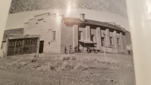
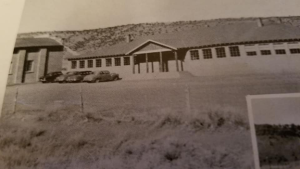
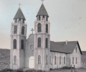

Las Mesitas
Mogote
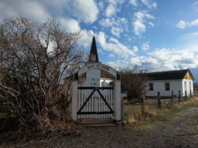
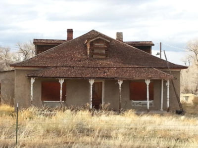
1854 – Mogote, six miles west of Guadalupe also known as Fort San Juan or San Juan. It is believed the first settler here was Juan de Dios Roybal, who arrived from Los Ancones, New Mexico. He marked the site he wanted with stones, and then headed back to Los Ancones. When he returned, his site had been taken by another, and so he settled on the north side of the Conejos River instead. Some of the first permanent settlers of the area were Jose Maria Suazo, Manuel Gonzales, Romon Gomez, Romolo Ruybal and their families. They named the community after the hills that reminded them of stacks of corn, or “mogote.”
Presbyterian missionaries arrived in Mogote in the 1889s and established a church in the community in 1885. A Presbyterian school was also opened, named the San Juan School. A post office was opened in the community, and operated from 1897 to 1920, and while there was no specific post office building, the post office was always operated out of the post master’s home, of which there were six over the period the post office was operated. The postmasters were Hocher – 1897-98, Luis Jaramillo -1899-1912, Juan B. Tafoya – 1913, Onesimo Suazo – 1914-1916, Epimenio Ruybal – 1917-1918, and Juan Valdez-1919-1920.
Mogote had a mercantile store located in the home of the Jaramilo family, located at the junction of Colorado Highway 17 and County Road D.5 which goes to Cañon. At its peak Mogote had approximately 350 residents. Mogote was a summer home for Utes; women and children stayed in the bosque while the men hunted. Most Spanish settlers were sheepherders. There were many weavers and carvers who lived in the community. Jim Fulton came to Mogote after working at El Rancho in Platoro. He was a fishing and hunting guide. He and his wife built their house in 1954 and built cottages in 1958. Eventually they sold their properties to Tommy Keyes and moved to Fox Creek. In 1936, Hank Hartley built Hank’s Riverside Store upstream on the Conejos River. He had worked construction on the bridge in 1908. His parents were from Fox Creek. Another trailer park in Mogote was built by Hubert Young in 1958. He bought his land from Geranio Sanchez. Originally called Cottonwood Meadows, it is now known as Twin Rivers.- Information provided by Jay Warner


Mogote
Conejos
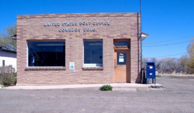
1855 – Conejos is established by the families from Guadalupe after the spring runoff floods their homes and they move to higher ground on the south bank of the river. The settlers name the new town “Conejos” for the abundance of rabbits and the river that separates the two villages. It is about a mile northwest of Antonito
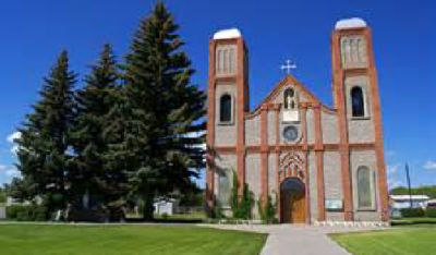
People moved from Guadalupe across the Conejos River in 1855 since it was on higher and drier ground. It was the principal trading center in the area until Antonito was founded on the rail line. Our Lady of Guadalupe Church was built in 1926 on the site of a burned adobe built in 1860. In1861, Conejos was the county seat of the newly created Colorado Territory.


Conejos
San Rafael
1854 –San Rafael is also known as “Paisaje.” When the post office in the community was established, there was already another San Rafael, and so the name Paisaje was used instead. Paisaje means “passage” in English, symbolizing the small hamlet being a gateway to the San Juan Mountains. –“Early Settlements of Southern Conejos County,” The San Luis Valley Historian XXIX, no. 4 (1997). Vicente Velásquez, Juan Bautista Chacón, Miguel Jaramillo, Antonio Trujillo, Bonifacio Romero with their families establish the community.
San Rafael was established around the same time as Guadalupe by settlers from New Mexico. The community came under the leadership of Jose Rafael Rodriguez. Those that settled this area wanted to be near those that settled the community of Guadalupe. They built adobe homes with gravel roofs and grouped their homes close together to protect themselves from invasions by Native Americans. The community was agriculture rich, growing beans, corn, and wheat, and using oxen instead of horses to aid in plowing fields. The community also raised sheep, and used the wool to make blankets and mattresses for their own survival. Native Americans often did attack, and once during an attack, Rodriguez lost all of his supplies including his wagon and oxen.
The settlers’ Catholic faith was very important to them, and would meet at different homes in the community to have Mass on Sundays. The first ever Mass celebrated in the community was on October 24, 1890. A home was donated by Juan Francisco Chacon to serve as the first church for the community in May 1891, and by March 1893, renovations had been done to turn the home into a chapel. Due to deterioration, a new church began construction in 1929, and was completed October 24, 1930.
“Early Settlements of Southern Conejos County,” The San Luis Valley Historian XXIX, no. 4 (1997).
Atanacio Trujillo donates a statue of
San Rafael (Saint Rafael the Archangel)
to the new church the town was named in honor of
San Rafael to protect the settlers.


San Rafael
Guadalupe
1854 – Led by José María Jáquez, Vicente Velásquez, Jesús Velásquez, José Manuel Vigil, Santiago Manchego, Juan de Diós Martínez, José Francisco Martínez, Juan Nicolás Martínez, José Chaves, Hilario Atencio, Antonio Chaves, Antonio José Chaves, and Juan de la Cruz Espinoza brought their families to settle the Conejos Land Grant.
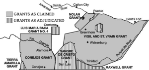
The Guadalupe-Conejos Grant was a Mexican Land Grant created in 1833 to allow for settlers from the small settlements and hamlets of today’s northern New Mexico to settle in the San Luis Valley. There were several failed attempts made by these Hispanic settlers to form permanent settlements within the grant, however, each attempt was met with the settlers being run out of the grant by Ute Indians. In August 1854, a group of settlers headed by Jose Marie Jaquez from Abiquiu, La Cueva, and El Llanito in northern New Mexico traveled north and settled four miles west of the current settlement of Guadalupe. Finding the new land acceptable, they returned to New Mexico to bring everything they possessed including sheep and cattle. On this trip, they were accompanied by Lafayette Head, who had served in the Mexican American War, served in the New Mexico legislature as a representative and senator, and after moving to Conejos County was appointed Indian Agent for the Tabeguache Ute band.
Guadalupe was one of the county’s first permanent settlements, however the community became threatened after the Conejos River flooded in 1857, resulting in the residents moving the community just southeast across the river to higher ground. Thus, the community of Conejos was established.
Guadalupe County was established as one of the original 17 counties of Colorado Territory in 1861. The name was short lived however, as the county was renamed Conejos just one week later. The county seat was early on also moved from Guadalupe to the town of Conejos just across the Conejos River.
The county at one time reached as far west as the Utah border, and encompassed the vast majority of southwestern Colorado.
Guadalupe for a period of time was lost, but did reappear. Today the community boasts a small population that still resides in a plaza style community around a central park through which Country Road 13 travels.



Guadalupe
Punche Valley
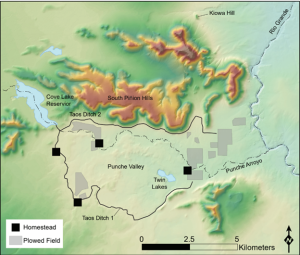
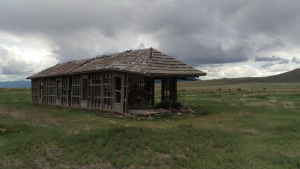
Late 1800s Early 1900s –Much of the land in this area was initially owned by Henry Jordan, who resided in the area with his wife Agnes in the late 1800s and early 1900s. It is rumored they owned three to five homes in neighboring Antonito. Much of the land was then sold off to John Sargent, who owned the Sargent Mercantile in Antonito. His grandson Pete “Buddy” Middlemist then came into ownership of the land. It has since been sold off to the San Luis Valley Irrigation Well Owners, Inc. “Farming in Punche Valley was completely reliant on water from Cove Lake and on the ditches that ran to the east and southeast through the valley. Cove Lake is a reservoir that was constructed on the north side of the Punche Valley between 1880 and 1883 and that was filled by the Taos Valley Canal No. 3 (Thompson 2017). The ditch head is located on the lower end of the San Antonio River, before the confluence with the Conejos River. Water rights for the canal were adjudicated in 1890 (Thompson 2017).” “Cove Lake filled as early as March or April and in most years provided enough water for the Middlemists to grow crops and water livestock throughout the year although the lake was often dry by November. Water was also delivered to Twin Lakes in the Punche Valley
for domestic and stock use (Thompson 2017). Buddy had always heard that the Taos Canal No. 3 and Cove Lake were built by Henry Jordan and that Jordan owned all the Punche Valley land before selling it to John Sargent in the 1930s. According to the stories Buddy heard, Henry Jordan was a surveyor for the railroad who must have come to Antonito sometime in the 1880s and was heavily invested in the sheep business.” The area is thought to have been home to a German POW Camp that operated during World War II, however no records have been uncovered. -Archaeology of the Rio Grande Natural Area 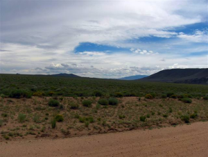

Punche Valley
Osier
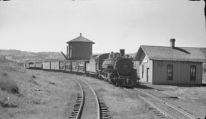
1880 –The original structures built at Osier include, the red frame 1880 depot, the section house that was built in 1884, a bunkhouse and coal house built in 1880, and a turntable that was retired in 1927. In 1880 when the depot at Osier opened, fare from Denver to Osier was $20.30. In 2024 dollars, that would be $624.02. In 1878, there was a fire in Osier that destroyed over 30,000 acres of timber on the Colorado side of the border alone. There were efforts made in the 1930s, and then major efforts in the 1960s and 1970s to plant trees to reforest the area.
The dining facility was dedicated June 30, 1989. Unfortunately, the kitchen caught fire on September 23, 2021, leading to extensive damage to the station. Due to the fire, access for passengers to the dining center was halted for the rest of the season. The dining center has since been reopened and passengers are able to enjoy lunch at the halfway point again.


Osier
Lobatos
1860 –The community was originally established as Cenicero, being that it was settled near the small hill known as, “El Cenicero,” located just about a mile south-southeast of the community. When a post office was established in the community in 1902, it was renamed Lobatos, after Jose Lobato, who was the village’s first postmaster. All maps will thus name the community Lobatos and not Cenicero. While a majority of today’s Conejos County residents call the community Lobatos, there are still those with ancestral roots in the area that will call it Cenicero. Presbyterian missionaries who arrived in 1860 began their work with Conejos County’s Hispanic population out of Cenicero. The first school in the community was operated by the Presbyterians.
“Early Settlements of Southern Conejos County,” The San Luis Valley Historian XXIX, no. 4 (1997).
Leland Feitz, Conejos County, A Quick History: Colorado’s Land of Many Contrasts (Colorado Springs: Little London Press, 1995).
“About 1868 a family at Cenicero secured a Spanish Bible from Santa Fe and when the Presbyterian missionaries came nine years later they found a group ready to organize a church which they did in 1878, in San Rafael in 1880, in Costilla in 1882, and in San Pablo in 1893.”
Luther E. Bean, Land of the Blue Sky People (Alamosa: O&V Printing, Inc, 2001)
Presbyterians were the first non-Catholic Christian group to organize churches and congregations in the county.
There are many legends and stories told of a battle that took place between a group of Kiowas and a group of Utes near Lobatos at a sight named Kiowa Hill, located east of the community. One legend states the Kiowas were known to raid the Spanish villages and Ute settlements. A battle broke out between the Utes and the Kiowas. To end the attack, a Ute woman sacrificed herself so that the Kiowas could be distracted while the Ute warriors attacked them. The woman was honored with an elaborate funeral in Lobatos.
“Early Settlements of Southern Conejos County,” The San Luis Valley Historian XXIX, no. 4 (1997).
“William A. Braiden (1865-1955) was a banker, rancher, and businessman in Colorado’s San Luis Valley. Born in Bellaire, Ohio, Braiden moved to La Jara, Colorado, in 1877. Braiden was most successful in ranching and related financial endeavors and owned vast areas of land, including the T-Bone Ranch in Cenicero, Colorado. Braiden was a firm believer in higher education and encouraged the young people in the area to pursue college, giving students small loans to enable them to do so.
Braiden and his wife, Josephine McKelvey Dillon Braiden, married in 1903 and had two children, Pauline and Wade, born in 1904 and 1908 respectively. Josephine Braiden died in 1932, and William Braiden married Maude Armstrong Chambers in 1936.“Braiden’s son, Wade Braiden, attended Colorado Agricultural College (now Colorado State University) from 1926 to 1928 with the intention of following his father into ranching. During his sophomore year in 1928, Wade Braiden died of pneumonia. In his memory, William and Maude Braiden donated $20,000 for the construction of a men’s dormitory. Braiden Hall was completed in 1948. In 1963, a new dormitory was named Braiden Hall, and the original dormitory became the Student Services building.”
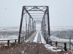
In 1892, a bridge was built across the Rio Grande connecting the communities of southern Conejos County with Costilla County. The bridge was built along County Road G and was named the Costilla Crossing Bridge. Many locals call the bridge the “Lobatos Bridge” as the community is one of the closest settlements to the bridge.
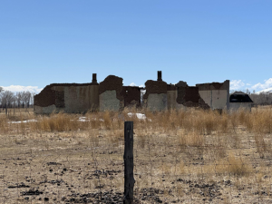
Today, Lobatos is a small community of rural residents and rural agricultural fields located between the large towns of Antonito and Manassa. The original plaza settlement is no longer standing, but there are still many community members who have ancestors with roots from the original settlement.


Lobatos (Cenicero)
La Isla
1860s-1880s –
The community of La Isla, “the island” in Spanish, was so named because it lies between the Conejos River to the north and the Rio San Antonio to the south and east. Celedonio Valdes, one of the petitioners for the Conejos Grant in 1835, owned much of the land in the area, and he was held in great respect by the people that lived there. The hamlet was named in honor of him, called La Isla de don Celedonio Valdes.
“Early Settlements of Southern Conejos County,” The San Luis Valley Historian XXIX, no. 4 (1997).
Leland Feitz, Conejos County, A Quick History: Colorado’s Land of Many Contrasts (Colorado Springs: Little London Press, 1995).
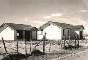
La Isla’s school was built in the late 1930s with funding provided by President Franklin Roosevelt’s Works Progress Administration. It is said the school was separated by heavy folding doors creating two separate classroom; one for lower grades which had a stage for performances and group activities, and the other for upper grades. There was a vestibule entrance where coats were hung, and that also housed a bucket of water, a dipper, and paper cone-shaped cups so students could drink water. Students would be paired up and assigned to prime and pump the day’s water from the well that was near the entrance. The school yard also housed a playground with chain swings, a merry-go-round, and seesaws. There were also two outhouses, one for girls to the west and one for boys to the east. The school was eventually closed in 1960 after it was consolidated with the school in Conejos, but was later converted into a dance hall. After it was completely abandoned, local children used the hardwood floors to play basketball or rollerblade.
Information provided by Ronald Rael


La Isla
La Florida
1870s-1880s –“The La Florida schoolhouse was constructed from basalt rock from the nearby hills with the help of my great-grandfather Miguel Francisco Barela, grandfather Salvador Casias, and cousin Carpio Dominguez, whose name can still be read scratched into a rock in the wall. Most of the children are unknown, except my Grandmother Crestina Barela Casias (the tallest girl in the center of the torn photo) and Pete De Herrera (front row second from right) in the same photo. If anyone recognizes people in the photos please share. The School House is still in great shape, a testament to its solid construction, and has been lived in since the 1960s as a private residence. There seems to have been a school in La Florida as early as 1892 taught by Presbyterian Missionaries as one teacher is listed as Ms. Mollie Clements, who taught there from 1892-2896. She was written about, and quoted, in the journal Home Mission Monthly from 1895. ‘There is no post office at La Florida, Colorado, and our teacher must, perforce, depend for her mail upon the good offices of the Mexicans who may happen to go into Antonito. “Frequently two weeks pass by with no opportunity for mail,” says Miss Clements. “Sometimes my neighbors go into town without my knowing their intention, and when, on their return, I ask ‘Did you bring me any mail?’ the reply is ‘I did not think of it.’ This may not seem much of a trial to some persons, but it really is to me, and I believe to all teachers situated as I am. Thoughtfulness with Mexicans is not one of their strong points. She goes on: She cites the fact that ‘inability to think is a great drawback to the progress of the Mexicans. Lack of energy is another drawback. It is so easy to put off doing a thing until it cannot be put off any longer. As a class there is no system about their work, and they seem to accomplish little for the time and labor expended. There are, of course, exceptions.” She also served Mogote for 23 years and the village of San Juan (which I believe may be what is known as Los Mogotes, or Mogote today). ” Information provided by Ronald Rael
La Isla’s school was built in the late 1930s with funding provided by President Franklin Roosevelt’s Works Progress Administration. It is said the school was separated by heavy folding doors creating two separate classroom; one for lower grades which had a stage for performances and group activities, and the other for upper grades. There was a vestibule entrance where coats were hung, and that also housed a bucket of water, a dipper, and paper cone-shaped cups so students could drink water. Students would be paired up and assigned to prime and pump the day’s water from the well that was near the entrance. The school yard also housed a playground with chain swings, a merry-go-round, and seesaws. There were also two outhouses, one for girls to the west and one for boys to the east. The school was eventually closed in 1960 after it was consolidated with the school in Conejos, but was later converted into a dance hall. After it was completely abandoned, local children used the hardwood floors to play basketball or rollerblade.
Information provided by Ronald Rael
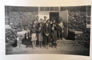
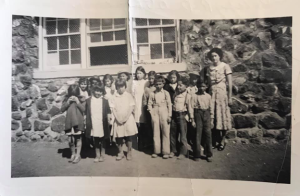


La Florida
Horca
1940s –Horca began as a collection of cabins built in the 1940s to provide vacation homes for recreational use, including hunting, fishing, hiking, and more. The current collection of homes is designated as a recreational community and is overseen by a landowners association that was registered with the state of Colorado in 2011. There is also an RV park and many empty lots that are for sale by individual landowners. There is a restaurant, a store, and a church, the San Juan Mountain Baptist Church that was built in 2008.
“Menkhaven Lodge was built in 1931 by the Menke sisters of Antonito, Colorado. Gladys, Dutch, and Hazel Menke grew up in Antonito, daughters of T.D.L. Menke, a prominent Conejos County businessman. Although the three sisters left Antonito for show business in the 1920s, Dutch returned to help run the family abstract business. Gladys and Hazel toured the vaudeville circuit for some 15 years, appearing on the same bill with such greats as Martha Ray, young Donald O’Connor, the Marx Bros., Bob Hope, the Mills Brothers, and many more. After the death of their father, Gladys and Hazel came home to Antonito and together with Dutch and their spry little mother, known as Queen, they built a resort, Menkhaven-on-the-Conejos, on 17 acres along the Conejos River. The huge log lodge and cabins, enough to house 50 guests, was a rustic sort of place, but totally comfortable, and only steps away from some of Colorado’s best trout fishing. The 18 cabins they built were named for their friends in vaudeville. Meals were served in the big dining room and sometimes the sisters would entertain guests with some of their old vaudeville routines. On weekends, big bands provided music for dancing not only for guests but for people from as far away as Alamosa. In 1957, after 25 years, the Menke sisters sold Menkhaven. Improvements have been made through the years. Nearly all cabins have complete housekeeping, and a 14-space trailer park has been added”-Menkhaven Lodge Brochure
Horca is located in a meadow at the junction of Elk Creek and the Conejos River. If you continue along Colorado Highway 17 to the south, you will pass through La Manga Pass and Cumbres Pass, each with tremendous sites that will bring you to Chama, New Mexico. Following Forest Service Road 250 to the west will take you further into the canyon and up to Platoro and other recreational areas.

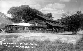

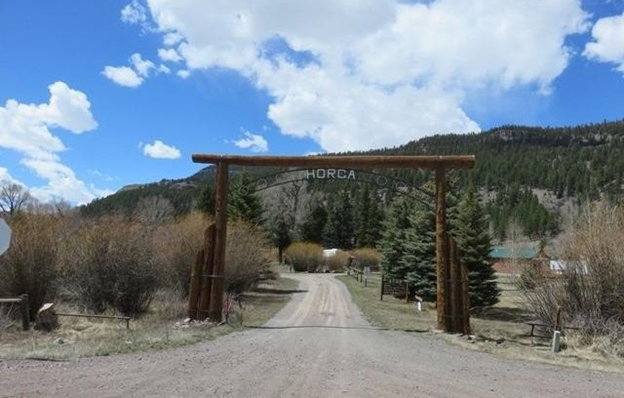
Horca
Fox Creek
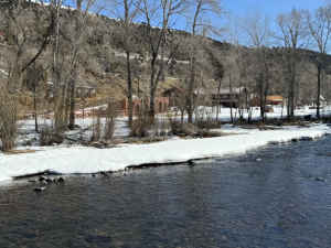
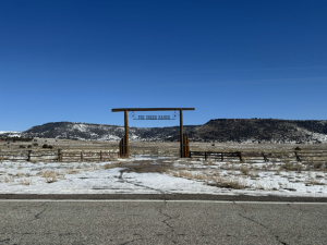
1887 –This area was first home to Hispanic populations. Located at the mouth of Conejos Canyon, Fox Creek was established as a Mormon community by Mormon pioneers from Utah in 1887. This colony was led by Laurence and Thor Peterson, who were brothers. Several non-Mormon families had already moved to this vicinity before the members of the church arrived. Other family names that settled in the area include Broyles, Hicks, Vance, Hartley, Von Cannon, Nance, Holtzclaw, and Winters. David Vance donated land for the schoolhouse and LDS church.
Fox Creek was an area much more suitable for ranching than farming, but there were still some patches of tillable land along the areas closest to the Conejos River and Fox Creek. In 1890, work began on an irrigation ditch to bring in water from the Conejos River to the settlement. Work was completed in 1893. At this time there were 94 people residing in the area, but within the next seven years the numbers began to dwindle, as the residents grew discouraged over economic difficulties and their remote location. By 1900, David Vance had the last Mormon family in Fox Creek and the LDS branch was closed.
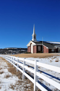
Today, Fox Creek is still a small community made up of full time residents, as well as summer homes. There is a small general store that is open during the warmer months, and a new LDS branch church was built in the community in 2003 as Mormons have begun to move back into the area.
Information from Jay Warner

Fox Creek
EEspinoza
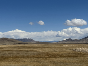
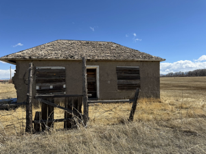
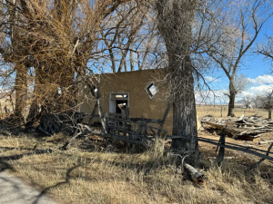
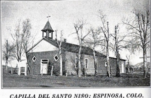
1900 –Espinoza is one of the oldest communities to have been settled near the Conejos River, and one of the longest lasting communities as well. It was originally named Los Fuertecitos, “the little forts,” and was later changed to Espinoza, named after Encarnacion Espinoza who lived in the area with his family. A post office was established in the community in 1905. Into the late 1940s, Espinoza continued to have a church, school, and general store that served those that lived south of Manassa. The adobe church, under much disrepair, stood in the community until the early 2000s when the roof finally collapsed, leaving only the walls standing. There are many other adobe structures in the surrounding area, while also in disrepair, showcasing the architecture of early Hispanic settlements. Espinoza was also home to artisans, including filigree jeweler, Alfred Mondragon. There are many families that continue to live in Espinoza, including large ranches. County Road 17 south from Manassa is often called “Espinoza Lane” by locals, a lasting legacy of the community.
“Early Settlements of Southern Conejos County,” The San Luis Valley Historian XXIX, no. 4 (1997).
Leland Feitz, Conejos County, A Quick History: Colorado’s Land of Many Contrasts (Colorado Springs: Little London Press, 1995).

Espinoza
Cumbres
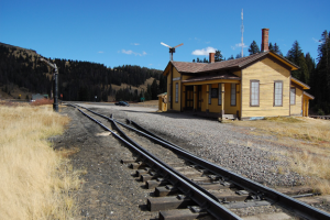
1880 –A post office was established at Cumbres the same time the rails reached the community. It served the small railroad population until 1937. At over 10,000 feet above sea level. Cumbres was often the sight of extreme snow storms and large amounts of snow. Due to the many corrals located near the depot, Cumbres became a shipping and supply point for sheep and cattle.
Today, the settlement is nothing more than the railroad depot that still stands and serves as a stopping point for water for the Cumbres and Toltec Scenic Railroad.

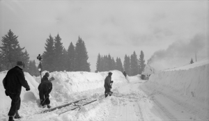

Cumbres
Cañon
1871 – Cañon began as a collection of little farms and a community for sheep ranchers. The community once had its own rural school. Cañon was also home to two commercial weavers, Librado and Epimenio Garcia, who lived here in the early 1900s. There is a possible connection between Cañon and La Placita de las Maes, which was located in the same general vicinity as Cañon. The placita belonged to Don Quirino Maes, and was deserted before 1940. Information from Jay Warner


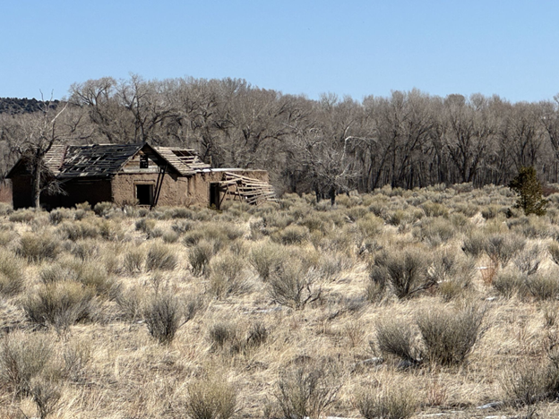
Cañon
Costilla County
Hispanic settlers from the Taos Valley established several small villages along the Rio Culebra in the San Luis Valley and officially took possession of this portion of the Sangre de Cristo Land Grant on April 5, 1851. Settlers built a church in the central village of La Plaza Medio and dedicated it on the Feast of Saint Louis, June 21, 1851. The village was renamed San Luis de la Culebra in honor of its patron saint. San Luis remained part of the Territory of New Mexico until 1861 when the Territory of Colorado was established. Today, San Luis is the oldest continuously inhabited town in the state of Colorado.
The Villages of the Culebra River: Chama, San Pedro, Los Fuertes, Garcia, Jaroso, San Francisco, San Acacio, and Mesita are quaint and full of culture that has been passed down over centuries. Here the native and the sacred are one, and folklore, stories and old wisdom are alive. This is not a big-time tourist route, but rather a land of mission churches, long winters and patience. This is the home of the penitente religious brotherhood, with roots in sixteenth century Spain. People farm, raise children and celebrate fiestas, baptisms, and quinceaneras (young girls rite of passage) and other old-time traditions like Las Posadas and Mis Crismas.
Costilla County is also home to Fort Garland Museum, which is a historic adobe fort that was once commanded by Kit Carson. Just west of Fort Garland is the town of Blanca, once a railroad stop for shipping trainloads of produce out of the San Luis Valley, is now a quaint town with incredible views of Mount Blanca, standing 14,345 feet tall.
The People’s Ditch is Colorado’s oldest water right and flows through the town of San Luis, just down the road from Colorado’s longest continuously running business, R&R Market. Near the center of town is the start of an incredible religious walk. The Stations of the Cross Shrine, a series of bronze sculptures, dedicated in 1990, winds up the Mesa de la Piedad y la Misericordia (Hill of Piety and Mercy), which oversee the town of San Luis. View the stations created by Huberto Maestas as your steps wind up to the La Capilla de Todos los Santos, a Catholic Chapel that sits atop San Pedro Mesa. The summit overlooks the farms of the Culebra River villages. The farms were laid out in narrow strips from 55 to 1000 feet long, measured in varas. Fields of wheat and pinto beans, carefully irrigated apple orchards, long narrow plots of potatoes, corn and high-altitude crops like habas or fava beans are well tended.
Explore three isolated State Wildlife Areas and four reservoirs for hiking, fishing, hunting and wildlife viewing along with Colorado’s southernmost 14er, Culebra Peak.
Towns in Costilla County
Blanca
1908 – The Costilla Estates Land Development Company, in a land development scheme offered a lottery for 5 acre lots, and those purchasing lots would become eligible to win larger tracts of land. The town was named “Blanca” because it is at the foot of Sierra Blanca.
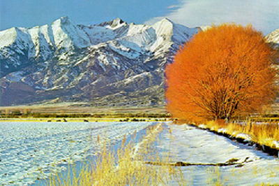
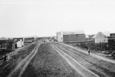


Blanca
Fort Garland
1858 – The US Army built Fort Garland to replace Fort Massachusetts, which is eight miles north. This new fort location was easier to defend and has a parade ground. The new fort was named in honor of General John Garland, General of the New Mexico Department of the Army. Fort Garland consisted of a group of adobe structures set in a rectangular form, similar to what you can view now that the State Museum at Fort Garland. There was a post office and Sulter’s Store and many farmers settled nearby and they grew crops to sell to the army. Among early settlers were Antonio Baca, Charles Newton and is wife Maria de Los Reyes, Tom Tobin and his wife Pasquela Bernal, although their main house was in Costilla. In the mid 1860s Kit Carson and his wife Maria Josepha Jaramillo of Taos commanded the fort for one year. An adobe church was built and is north of the present day Catholic church. The arrival of the Rio Grande Railway in 1878 grew the town but the fort was abandoned by military in 1883.
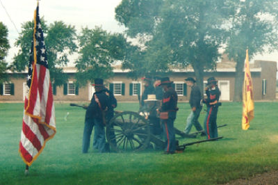
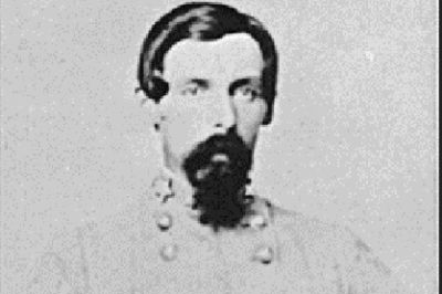
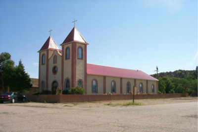

Fort Garland
Jaroso
1909 – The village was named Jaroso because of the willows growing along the irrigation ditches. Jaroso was established by the Costilla Estate Development Company to attract farmers to this part of Costilla County.
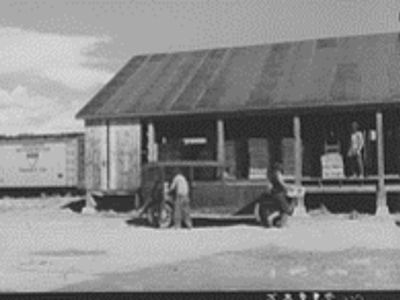
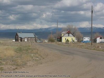
There were no settlers in the Jaroso area until 1890 when a group of Mormons built a little town called Eastdale a couple of miles northwest of present day Jaroso. The town plat was filed in 1914. The Shedd Investment Company in Omaha worked in association with the Costilla Estates Development Company to bring a settlement of Seventh Day Adventists to Jaroso. By the spring of 1915, twenty-five to thirty families had settled. It became a commercial center for a vast area of northern New Mexico. Field peas, potatoes and hogs were plentiful. Just as the town was peaking, the boom came crashing down. The Merchants Bank and the Mesita State Bank failed in 1919. Welker’s General Store burned to the ground and the San Luis Southern Railroad went bankrupt. There was a small upswing when George T. Kearns of the Kearns Timber Co. purchased the San Luis Southern Railway. They started a bus service from Jaroso to Taos, which was actually a 1924, V-63 Cadillac Suburban and a truck for freight that couldn’t fit in the Cadillac and brought service only when the weather was fair. The depression of the 1930’s ended this service and brought more hardship. Then in 1932 a blizzard buried the daily train and it was two weeks before the rails were open again. More snow drifts closed train service for weeks and food and supplies were gone.
The population decreased in the 1930s, but Jaroso continued to survive. The passenger train shut down in 1946 and freight trains stopped in 1958. The stores in Jaroso are all closed now, as well as the hotel. The larger farms still operate growing barley and potatoes. The views of the isolated landscape and wild horses truly bring you back to the Wild West roots that were put down here a century ago.
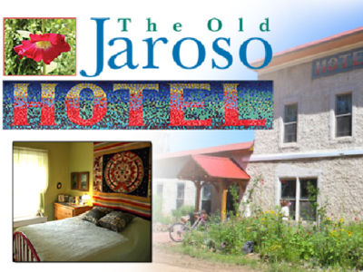

Jaroso
Mesita
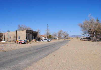
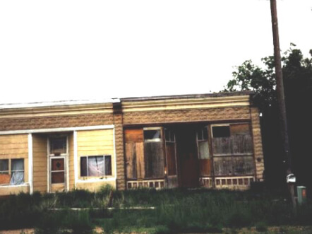
1909 – The Costilla Estate Development Company offered tracts of land to settlers to attract farmers and sell land. Village named for the nearby small mesa. It is located north of Jaroso. Many of the settlers were Anglo although the Mondragon family ran a store there.


Mesita
Chama
1854 – Established by settlers from Chama, New Mexico
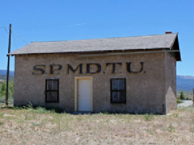
Four miles southeast of San Luis and located on the Culebra River, this town was sometimes called Culebra. The feast day of Santiago (St. James) was a major celebration drawing people from the entire region. Prominent families included the Lobatos, Sanchezes, Ortegas, Jacqueses and Villapandos. The baseball team was renowned and was also home to a post office, school, morada, catholic chaple, two cemeteries(Catholic and Pentacostal). The SPMDTU lodge hall still stands and is on the National Register of Historic Places.


Chama
San Francisco/El Rito/La Valley
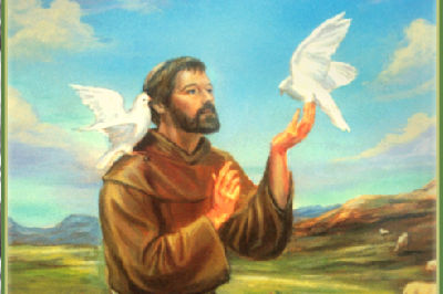
1854 – Founded by several families from Amalia, New Mexico. Named in honor of San Francisco de Asís, the patron saint of animals. Although the stream is called San Francisco Creek, it was originally called El Rito Gregorio and when the post office opened in 1903 is was called La Valley. The first chapel was built in 1856. The Penitente Morada here was the most active and largest in Costilla County. The population had strong Pueblo Indian representation.



San Fransico/El Rito/La Valley
Old San Acacio – Viejo San Acacio
Settlers establish a town in 1853 but had no name. The legend of this area is that settlers saw a band of natives ready to attack so they prayed on their knees to San Acacio, patron saint of soldiers. The natives turned away sparing the settlers lives, later stating that they saw an army of warriors in the sky preparing to defend the settlers. The town was then named in honor of San Acacio. An Oritorio was built that same year and the existing church was completed in 1856. The structure is said to be the oldest standing church building in Colorado. The oratorio’s traces are a few yards east of the church near the irrigation ditch, where now an abandoned morada sits.

Old San Acacio
New San Acacio
San Acacio is located in the Rio Culebra valley of the Sangre de Cristo Land Grant which was awarded to the family of Carlos Beaubien in 1843. The town, new San Acacio, was built in 1910-1911 when the San Luis Southern Railway ran south from Blanca to Jaroso. It was an active center for agriculture and shipping produce. The community was named after Saint Acacius.
The largest depot constructed by the San Luis Southern Railway in 1910, a 32-mile standard gauge railroad built to serve the towns and farms planned by the Costilla Estates Development Company. The two-story depot also served as railway headquarters until 1950, and it is all that is left in San Acacio to represent the railroad and the company that created the town. The San Acacio Post Office was established in 1909, and remained in operation until 1992.

New San Acacio
San Pedro y San Pablo
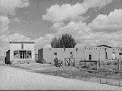
San Pablo is about three miles southeast of San Luis on the south side of Culebra Creek and San Pedro is in the same location but on the north side. The whole area is sometimes called San Pablo. Settlement was first attempted in 1849 by they were driven out by Native Americans.
San Pedro was sometimes called Plaza Arriba or Upper Culebra and San Luis was called Plaza de Medio or Middle Culebra. The San Pedro ditch dates from 1852. It is said that San Pablo was home to the main church of the area before it moved to San Luis. Priests came from Taos and later Costilla. The first school was built in 1890 and then two others. The second school was also used for community dances before it burned down in 1936.
1852 – Juan Salazar, Benacio Jáquez, Antonio José Valdez establish the town of San Pedro in honor of Saint Peter, holder of the keys to heaven.
1852 – San Pablo founded by José Antonio Vallejos in honor of Saint Paul.
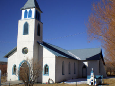
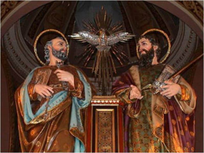
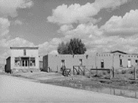
San Pedro y San Pablo
San Luis
1852 – Carlos Beaubien invites settlers to settle area by giving land. Juan Manuel Salazar, Julián Gallegos, and other settlers establish the town on June 21, 1852 on the feast day of San Luis (Saint Louis). San Luis is the oldest town in Colorado, has the longest continuously run business(R&R Market) and the People’s Ditch is the first water right in the state of Colorado.
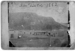
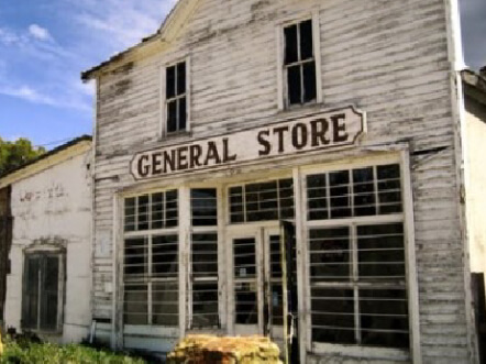
Established in 1851, San Luis is the oldest continuously occupied town in Colorado. The town was established by Hispano farmers, but it should also be noted that the area had been inhabited by prehistoric cultures that date back thousands of years. Hispanic settlers from the Taos Valley established several villages along the Rio Culebra in the San Luis Valley. It was once called La Plaza Medio, but the village was later renamed San Luis de la Culebra in honor of its patron saint. San Luis was once a part of the Spanish land grants that were decreed by the King of Spain. It wasn’t until 1851 when the settlers officially took possession of this portion of land. The town’s adobe architecture and classic Spanish town layout display the historical and cultural influences that have shaped many early communities throughout Southern Colorado. San Luis remained part of the Territory of New Mexico until 1861 when the Territory of Colorado was established. With the introduction of the railroad and its close proximity to the main roadway that led south to Taos and north to Fort Garland, San Luis quickly became the hub of the region. Many of the town’s historic buildings have maintained its historical integrity, and the center of the town is now part of the Plaza de San Luis de Culebra Historic District, which has been listed in the National Register of Historic Places. Further, the R&R Market, established by Costilla County pioneer Dario Gallegos, was built in 1857 and is the oldest business in the State of Colorado.
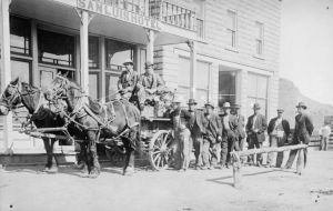
San Luis
García/La Plaza de los Manzanares
1849 – Manuel Manzanares and his brother are encouraged by Luis Beaubien to settle the land grant. The plaza is known as La Plaza de los Manzanares.
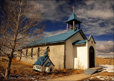
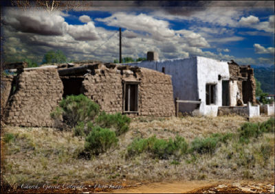
Several years later Guillermo and Agapito García petition for a Post Office and is named in honor of their last name. They were one of the first colonists of the Sangre de Cristo Land Grant. The Manzanarez Ditch, taking water from the Costilla River wa decreed in 1854 and Pedro Manzanarez operated the flour mill. Catholic familiies in the plaza attended church in Costilla but had a chapel in Garcia too. There was a Penitente morada at the plaza, and missions were operated by Presbyterian, Methodist and pentacostal churches as well.